Ah, yes, Google Maps. I've used them often, from vacation planning, to geotagging photos, and sometimes for fun.
The mashup I created was for a blog post I did last fall on 13 places with Halloween-ish names.
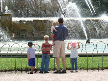
View Larger Map
Really, I did embed the map into this post, but it's stuck on "loading" for me. :-)
I did have a bigger plan in mind for Google maps, that of mapping locations for children's museums around the country, but I found one big limitation (after hours of input)--there's a limit to the number of places that will show up on the map. (I think it's 100.)
I also like the integration with Google Earth. When I geotagged some photos recently, I was able to see exactly where the photo had been taken by looking at the combination of roadmap and satellite image.
Thursday, January 22, 2009
Subscribe to:
Post Comments (Atom)


 Digg/minnemom
 Flickr/minnemom
 Twitter/minnemom
 Del.icio.us/minnemom
 GMail/minnemommy
 Technorati/minnemom
 Blog/Travels with Children

No comments:
Post a Comment